


Photographers Guide to Photographing Death Valley
Photographers Guide to Photographing Death Valley
I have never met a landscape photographer who didn't love Death Valley

Hi, I am Charlie Borland and welcome to my All About Photography newsletter. I have been a pro photographer for over 40 years and have a lot to share with you. Please join the photo adventure by subscribing.
Death Valley is often considered an amazing place to photograph due to its unique and diverse natural features, which offer breathtaking landscapes and stunning photographic opportunities. The park boasts an otherworldly and surreal desert environment with its vast salt flats, sand dunes, rugged mountains, and colorful badlands creating dramatic and visually striking landscapes. The interplay of light and shadow across these diverse terrains provides a captivating subject matter for photographers.
If you are enjoying this post, please share it.
Landscape photographers are drawn to Death Valley for several reasons including its remarkable variety of geological features including its vast salt flats, towering sand dunes, rugged mountains, and colorful badlands. The desert environment of Death Valley presents photographers with dramatic lighting conditions intense sunlight, deep shadows, and the interplay of light on the textured surfaces of the landscape create dynamic and visually striking scenes. The wide-open spaces also allow for dramatic compositions and the ability to capture the full range of light and shadow.
Death Valley is known for its vivid and ever-changing colors. The stark contrast between the bright blue sky, golden sand dunes, red-hued rocks, and white salt flats creates a vibrant and captivating color palette. During sunrise and sunset, the warm hues of the sky cast a magical glow over the entire landscape, enhancing its photographic appeal.
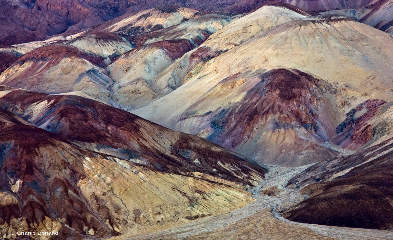
The geological formations found in Death Valley are incredibly diverse and captivating. The famous Zabriskie Point, Artist's Palette, and the Mesquite Flat Sand Dunes are just a few examples of visually striking formations that photographers can capture.
There are also extreme weather conditions, including scorching temperatures and intense storms that can result in extraordinary photographic opportunities. The rare occurrences of rainstorms and the subsequent wildflower blooms transform the arid desert into a colorful carpet of flowers, creating a unique and mesmerizing sight for photographers.
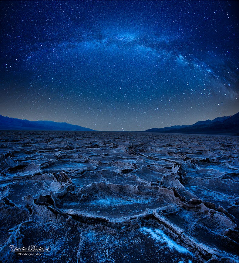
Death Valley National Park is designated as an International Dark Sky Park, making it an ideal location for astrophotography. The park's remote location and minimal light pollution provide an excellent opportunity to capture the beauty of the night sky. Photographers can capture stunning images of the Milky Way, star trails, and celestial phenomena against the backdrop of the park's distinctive landscapes.
It's important to note that while Death Valley offers exceptional photographic opportunities, it is also an extreme environment with challenging conditions. It's crucial to be well-prepared, stay hydrated, and respect the fragile landscape while exploring and photographing the park.
If you are enjoying this post, please share it.
As a photographer, I thoroughly enjoy photographing landscapes and have been to the park many times, photographing for my stock photo files and teaching workshops. As a result, I have a list of my favorite locations that you do not want to miss.
The Sand Dunes
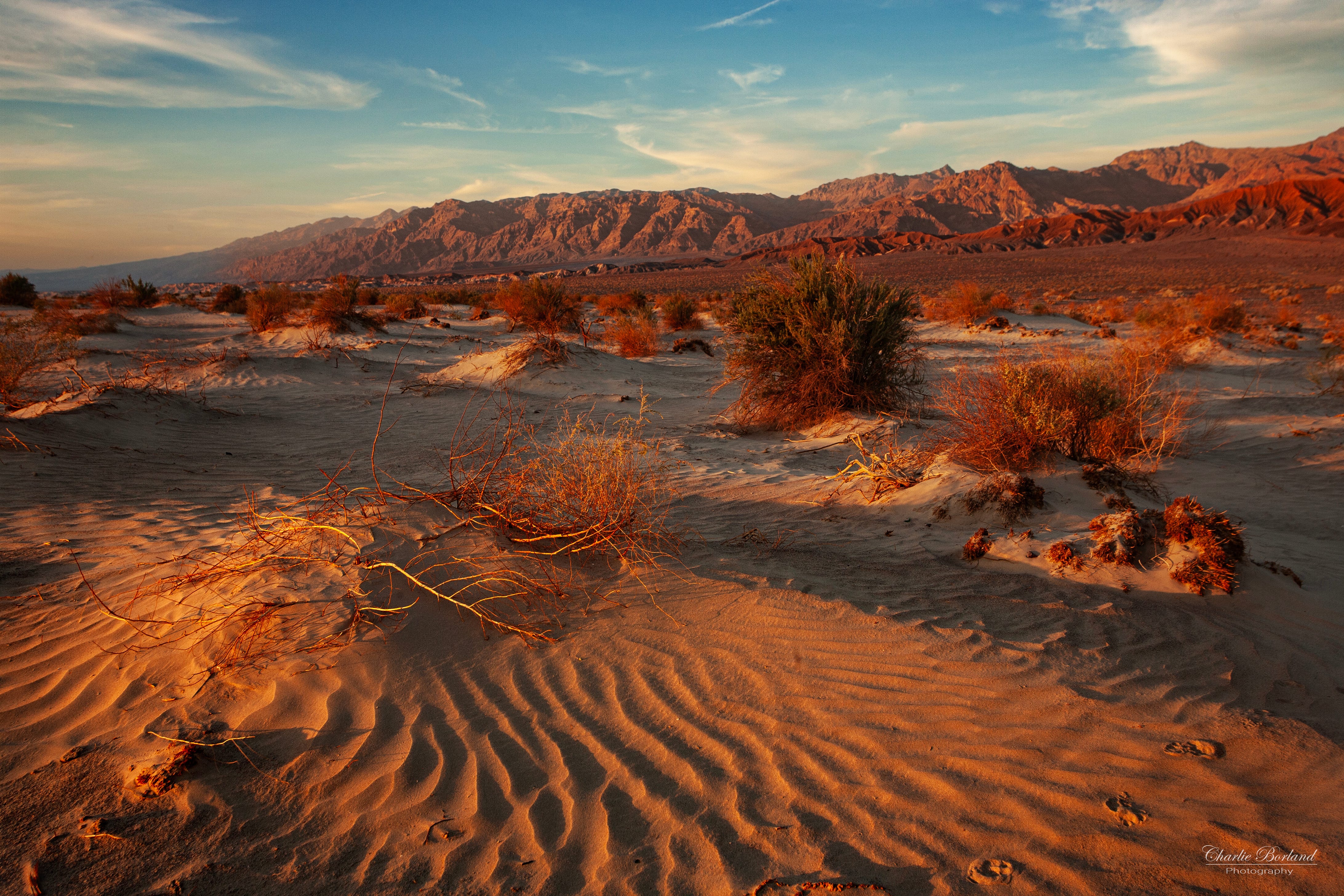
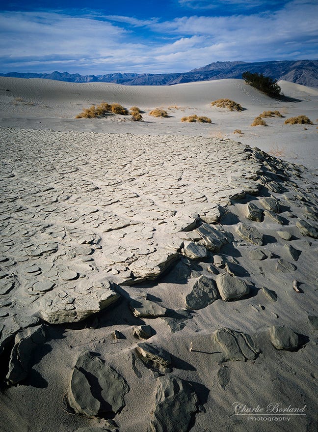
One of my favorites is the Mesquite Flat Sand Dunes. These iconic sand dunes are located near Stovepipe Wells and offer an excellent opportunity for capturing striking images of the undulating patterns and textures created by the wind-blown sand.
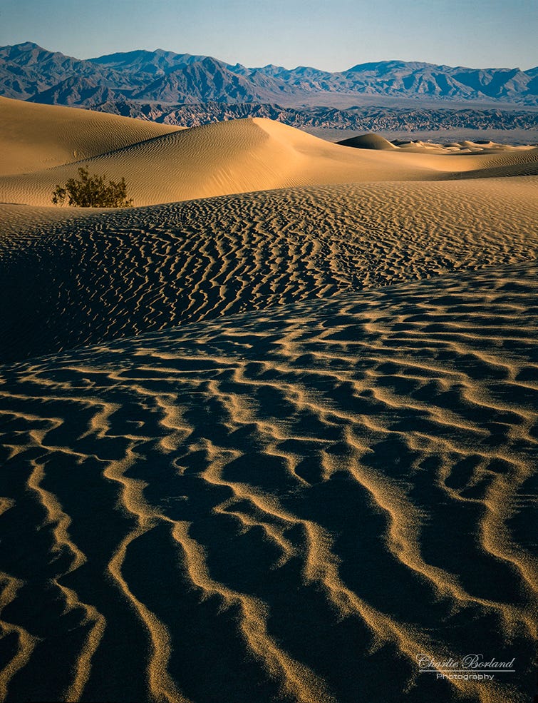
The late-day lighting is the best time to be there and as the light drops near the horizon, it can still light the dunes with warm golden hour lighting depending on the time of the year.
Pro tip: Death Valley is very popular and especially the dunes and this means that the texture of the dunes can get trampled with footprints, making it challenging to find the delicate patterns and textures of the windswept dunes. Consider entering the dunes further to the east. There is much less foot traffic and finding more untouched dunes is easier. See map #01
Zabriskie Point
Zabriskie Point is another popular sunrise location. Known for its panoramic views of the badlands, this spot is a popular spot for landscape photography. It provides a remarkable vantage point to capture the golden hues of the surrounding hills and the dramatic erosion patterns.
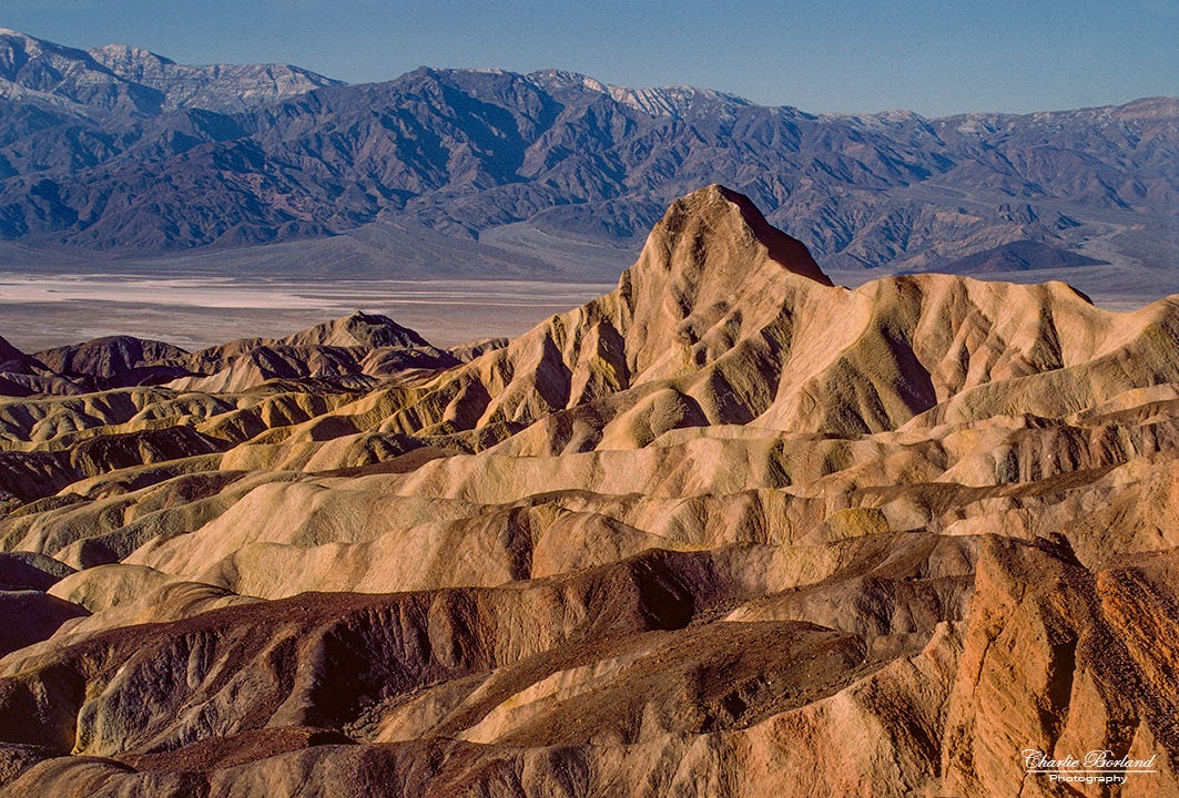
Manly Beacon from Zabriskie Pt.
But also know that this post is easy for everybody to get to and can be crowded. In fact, it was overused so much that the park service did some construction to keep visitors behind a wall. Location #02 on the map.
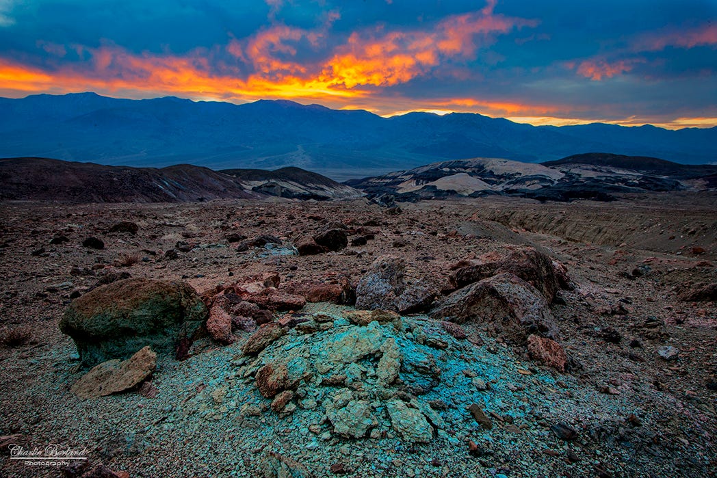
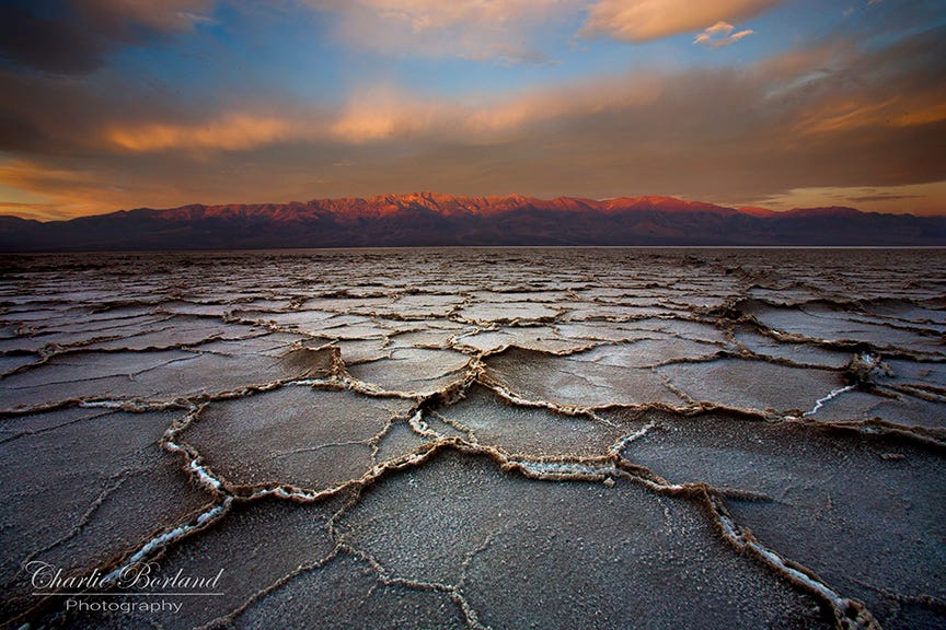
Badwater Basin
Badwater Basin is an amazing place and is the lowest point in North America. It offers a unique photographic experience due to the vast salt flats stretching out before you, creating mesmerizing patterns and reflections that can make for compelling images, especially during sunrise or sunset.

You can capture this image of the water and mountains in front of the Badwater parking lot, then take the trail further out for a different perspective.
Pro Tip: Leave the crowds at the Badwater area and drive about 1 mile south, pull off the side of the road, and hike down to the salt flats for fewer crowds and unusual formations. See map #3.
If you are enjoying this post, please share it.
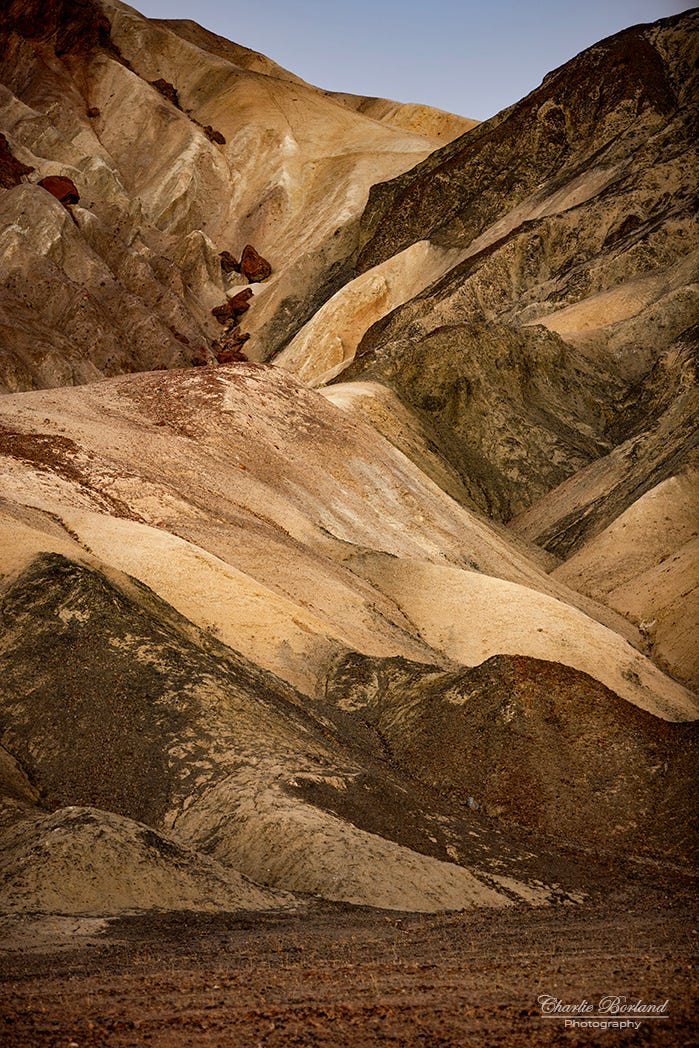
Artist Palette
Artist's Palette is one of the best examples of Death Valley’s rich geology. Located in the Black Mountains, Artist's Palette is a colorful mineral-rich formation that provides an excellent subject for photography. The vibrant hues, caused by various minerals present in the rocks, make for striking compositions.
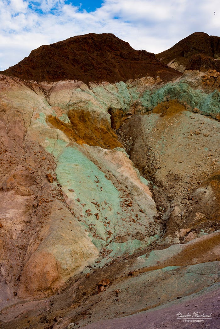
Pro tip: This location is better in overcast light IMO. The harsh desert sun creates lots of lighting contrast with dark shadows. While that same sun makes the colors really stand out, the lower contrast of an overcast day allows you to process your images and add the color vibrancy you prefer. See map #04.
The Racetrack
This location is a challenge to reach and requires a bit of off-road driving. The Racetrack is an amazing place known for its mysteriously moving rocks that create trails across the playa. Scientists have been baffled for a long time as to what causes the rocks to move but discovered the reason in 2014 and you can read about it here.

Photographers wanting to make the arduous 83-mile drive can capture these rock trails against the flat, dry lakebed and be rewarded with an unusual phenomenon to photograph. Be sure you use a high-clearance vehicle and a satellite personal locator is not a bad idea due to zero cell service. See the map for #05.
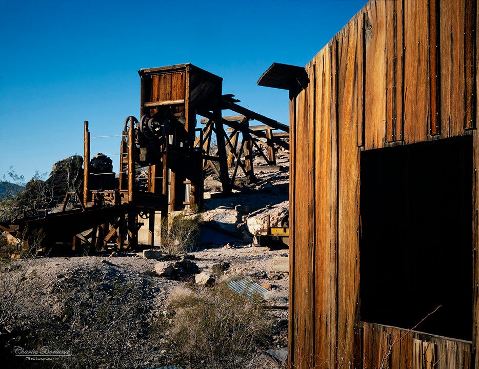
Inyo Mine
Gold was discovered at the Inyo site in January 1905 and soon came a booming mining camp with a blacksmith shop, boarding house, and general store. But due to financial problems, the company shut down in 1915 before being reopened around 1935 when the Inyo Consolidated Mining Company leased the claims to rework the old tunnels. Today, photographers can drive Echo Canyon road with 4x4 vehicles and reach the mine’s old buildings and they are worth a trip. See #06 on the map.
Harmony Borax Works
In the late 1800s, the Harmony Borax Works facility was constructed to process Borax and employed 40 men. However, due to the extreme summer heat, the processing did not work so well and the company relocated its processing plant outside of the valley. The Borax was then transported by the fabled twenty-mule team wagons move the product over a 165-mile journey.
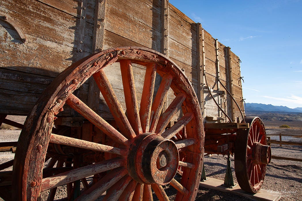
For photographers, the Borax works site is like a museum where the old wagons and mining equipment are on display. See map #07.
Devils Cornfield
The Devils Cornfield is really an unusual location. These so-called cornstalks actually fooled early-day settlers who thought they really were corn. But it is actually nothing more than gigantic Arrow Weed clumps that stand high above the salty desert floor.
Since Devil’s Cornfield borders the Mesquite Valley dunes, it is a good place to photograph the cornfield shocks in the low-lying dunes. See #08 on the map.
If you are enjoying this post, please share it.
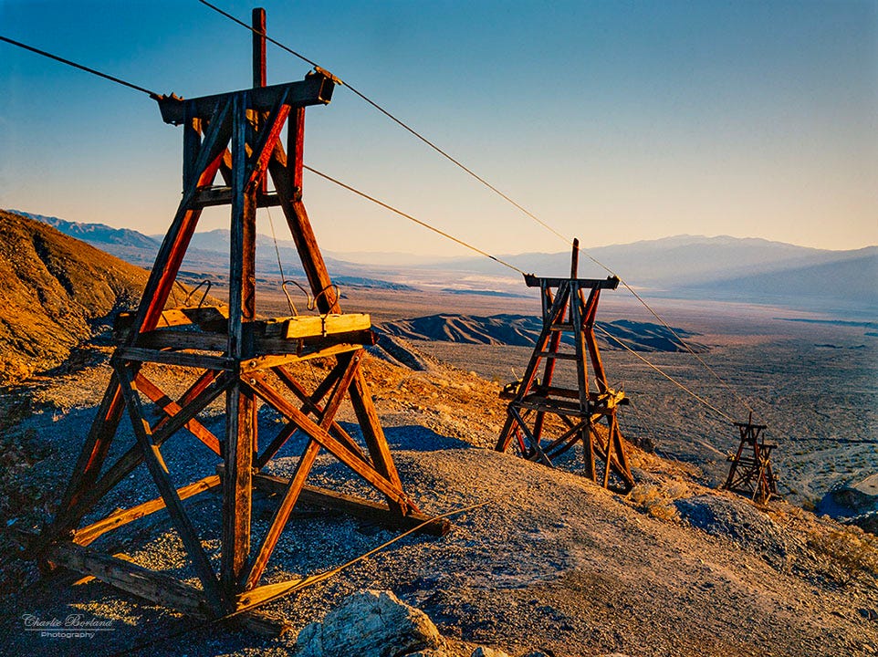
Keane Wonder mine
This mine is another great photo opportunity in Death Valley. The mine was in full operation by 1912 and many structures, are still there including its towers that moved the ore buckets. It’s a very photogenic location with plenty to offer the photographer. The national park service has also been restoring the old mine and preventing more deterioration. Afternoon to sunset is the best time for light at this location. See #09 on the map.
Devils Golf Course
Another favorite option for sunrise in Death Valley is the Devil’s Golf Course which is an immense area of rock salt eroded by wind and rain into jagged spires. Someone once said that the rock salt was so serrated that "only the devil could play golf on such rough links." It is a rough place, nowhere you want to hike around very far and most photos can be captured from the parking area, a safer place I am sure. See #10 on the map

My opinion is that the best times are before sunset when the light is soft, but also after sunrise despite the harsh light contrast. Or before and after sunset for mostly, the same light conditions.
Golden Canyon
Golden Canyon is considered one of the best canyons to explore. The short trail winds through golden canyon where the color appears to be a sparkly golden. The trail is a 4.3-mile loop that begins and ends off Badwater Road. However, the first mile is the most impressive and makes for excellent photography so you do not have to do the whole 4 miles. I have photographed here in the early light (shade) but also in mid-day and have achieved nice results both times. See map #11.
Saline Valley
The Saline Valley part of Death Valley National Park can be an exciting and adventurous experience. It is not located in the valley part of Death Valley, but with the right vehicle, is worth the visit. Saline Valley is a remote and isolated area located in the northern part of the park, known for its hot springs and stunning desert landscapes.
It is a lengthy journey of a very rough and bumpy road, but for the adventurous photographer, the reward is a campground and hot springs. As one website mentions: ‘Half of the adventure is just getting there in one piece, so any trip to a remote destination is a test of self-reliance.’ I went there around 1990 and by the time I got to the valley, most of my teeth had rattled out, but I was rewarded with some nice photos of untouched sand dunes. It’s shown on the map due to being basically off the map, but a stop at the visitor center will get you directions
Preparing for Death Valley
While Death Valley is an amazing place to photograph, be sure and plan accordingly. There are numerous lodging opportunities from luxury hotels to budget-friendly motels. There are several campgrounds from RV parks to dry camping opportunities.
Furnace Creek is most equipped for travelers’ needs including lodging, groceries, gas, and a cell signal. Stovepipe Wells has similar services, just not as much as Furnace Creek.
As a reminder, Death Valley is a vast area and while cell service has improved, there are still areas with no service, so if you are going to venture far off, have a backup plan if you get stuck.
The time you plan to visit can impact your experience. Winter and late fall are the times I have visited and the trips have been perfect temperatures which I call ‘shorts and t-shirt’ weather.
If you are enjoying this post, please share it.
Summer is a whole different experience and requires serious planning and preparation. Summer temperatures can be insane and dangerous. They can be over 125ºF with the highest recorded temperature of 130. The ground heat index can be over 165ºF creating the scorched earth look of shimmering heat waves rising. People have died due to the heat! My visits to Death Valley have all been in January and November, both very comfortable times to go.
Remember, Death Valley is a vast and diverse national park, so explore beyond these locations as well but make sure you have the right vehicle for rough road conditions. Be sure to check weather conditions as well and bring 4 times the water you think you will need. There is no cell service in many areas so a satellite GPS locator beacon is a great idea. Plan for all appropriate safety measures, and respect the fragile desert ecosystem while photographing in the park.
Download this map with all locations marked in yellow.
Support this Channel: Take a Photography Class

Online courses on Architecture and Real Estate Photography, Landscape & Nature, Professional Commercial Photography, Professional Nature Photography, Wireless Flash, and more.
Click HERE
Buy Us a Beer
We would love to have you as a subscriber, either FREE or paid, but if you are not ready to be a subscriber. Consider buying us a beer.


Hey, thank you very much Anthony! Happy to share with everybody.
Wow, this is great info! Thanks for sharing Charlie.